
In the middle of July my brother, Tommy, and I (George) made a trip to Northern Ireland. This was not the usual tour bus, guided, safe and sound, beaten path type of trip. Multiple times we found ourselves in frightening situations that required the grasping, arms-shaking, breath-holding type of perseverance to continue on our journey over cliffs and in caves.
Flying into Belfast at the crack of dawn gave us all of Saturday to explore our first destination – Rathlin Island. The ferry that departs Ballycastle is only suited for walk-on travelers, and the 30 minute ride gave us great views of the Fair Head cliffs. Once docked at Church Bay we met our host, Margaret, the proprietor of Coolnarock B&B. She drove us a mile to the B&B and informed us of everything we needed to know to have a successful day on the island. She stopped a few times to speak with friends along the way – Margret is definitely an important member of the close-knit community. Her late father was a life-long resident of the island and wrote an extensive, no-stone-unturned account of the history of Rathlin including specific information about the families who spent their lives on the island. I highly recommend reading his book! From the map below you can see that the island is a reversed L-shape, 4 miles (6km) east to west and 2.5 miles (4km) north to south. It’s small enough to cover in one day but big enough to get lost.

Tommy and I bought some ice cream from a boy who was so young he could hardly add the numbers to know what to charge us. We walked to the ferry dock to catch the bus to our next destination. Burt’s Puffin Bus took us to the RSPB Seabird Centre located on the western end of the island. This is the main attraction and day visitors come to Rathlin for the spectacular birding. You can walk, but it’s a difficult 4 miles to and 4 miles back from the Seabird Centre, so I would recommend the £5 return bus service. There is also a small fee to enter the Centre, but they have staff to point out the puffins, and telescopes to give you a close view of these amazing birds. Note Bene: you will not get a good picture of puffins unless you have a very powerful telescopic camera lens. Don’t believe the photos you see online. The puffins are about ¼ mile away from the closest viewpoint.
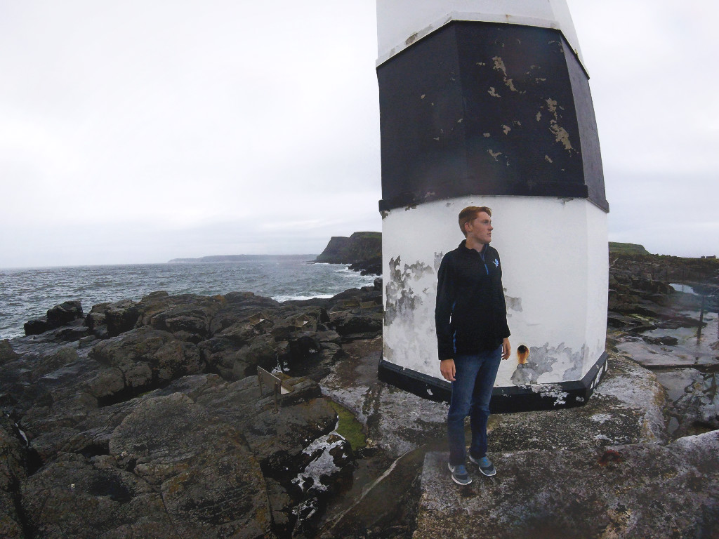
On the bus ride back Burt was kind enough to drop us off at Mill Bay – where the seals congregate. We saw a dozen seals and they all have a habit of poking their heads out of the water and staring at us. Tommy and I decided to climb along the rugged shore line in hopes of reaching Rue Point – the South Lighthouse before our dinner reservation at McCuaig’s Pub. The coast was lined with 50m high cliffs that were topped with pasture land. We climbed along the rocks where the cliffs meet the sea. This was difficult walking/bouldering and we had to jump a few fences along the way. We came upon a cave which we cautiously entered. Our useless flashlight made us disappear into complete darkness only 10 meters into the cave. Little did we know that this cave was 500ft long and the site of the Rathlin Island Massacre of July 1575. Beneath the lifeless dirt floor lays the bones of hundreds of women and children that fled to this cave during the attack. Sir John Norreys’ soldiers hunted those hiding in the caves and, despite their surrender, killed all who lived on the island. This was the first of the three known occasions the the whole population of Rathlin would be extinguished. – We left the cave. It was spooky, and we were straight up scared. Note: Andy McInroy has extensively photographed Rathlin’s caves. His website should inspire you to explore the island’s secrets.
As we climbed along the coast each time we turned a corner of cliffs we were sure the lighthouse would be in sight. After a few hours of this we finally checked Google Maps and saw that at this rate we would never reach the lighthouse before dark. We found a grassy route up the cliffs and traversed pastureland to find the lighthouse. After passing a lake and jumping a few more fences we finally reached the lighthouse. We jogged the few miles back to the pub and passed only two inhabited houses. There were plenty of stone ruins along the way. Most are remains from potato famine times when the island was deserted.
McCuaig’s pub was the only choice, so I cannot complain about the food. Good for a drink, but if you have the option to eat at your accommodation I would suggest it. The sun sets at 11pm in July, so Tommy and I stayed up reading books on the sordid history of the island. The next morning we walked to the third and final East Lighthouse before catching our ferry to the mainland.

One thought on “Northern Ireland Day 1: Rathlin Island”